
The land between two canyons where a once mighty river abruptly changes direction on it's long journey to the sea, creating a natural boundary in an unspoiled wilderness.

Days at Park: Thu-Sat, 19-21 December 2019
Base Camp: Big Bend Resort & Adventures - Terlingua, Texas
Expedition Parks: Guadalupe Mountains, Carlsbad Caverns, Big Bend, White Sands
Point of Embarkation: El Paso, Texas
It is a long and lonely drive to get to Big Bend country through a landscape dotted with distant mountain ranges, past pecan groves, cattle ranches, and roadside picnic areas, and through small west Texas towns like Valentine, Marfa, and Alpine. Along the road, just outside Valentine is a head-turning piece of art that brings many travelers to a stop for a quick photo op. Free-standing alone in the Texas desert is a replication of a Prada storefront window complete with shoes and purses on display. https://www.ballroommarfa.org/archive/prada-marfa-an-explainer/
Another notable roadside attraction is a surprisingly large and modern viewing area for the not-so-infamous Marfa lights. Apparently, the mysterious nighttime lights dance across the desert horizon and have no scientific explanation (at least none that satisfy the local admirers).
There are no towns along the final stretch of 80 miles from Alpine to Terlinqua, which lies just outside the national park boundary, serving as a good jumping off point for visits to the park. On the road leading into the park is a gem of a general store named Cottonwood. This small but deceivingly well-stocked shop is full of nooks and corners with a surprising supply of foodstuff, dry goods, and camping gear.
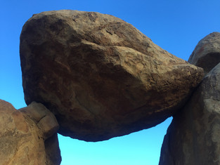
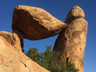
Grapevine Hills
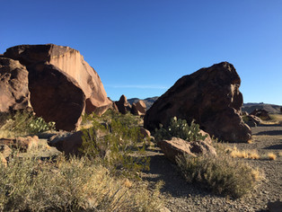
Off the main road leading to Panther Junction is a turn-off which will take you to the trailhead for Grapevine Hills. This road, in the loosest interpretation of that word, deteriorates as you drive along it's 6-mile length and had me more than once rethinking my determination to reach the trailhead by car. Once safely parked, it was an enjoyable hike through the middle of a tiny canyon ending in a scramble up the rocks to reach Balance Rock, where I spent a meditative morning.


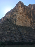
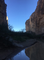
Santa Elena Canyon
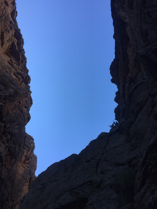
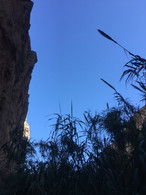
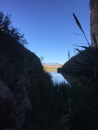
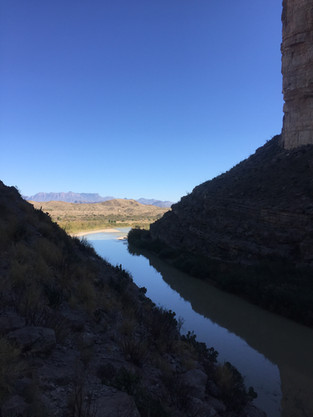
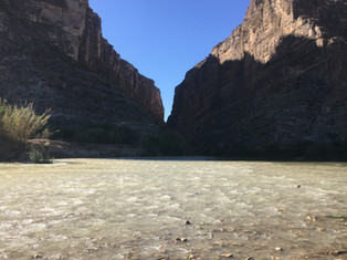
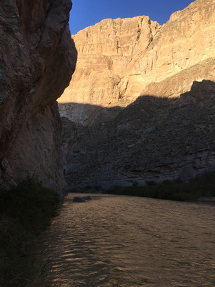
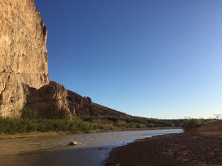
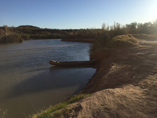
From Panther Junction Visitor Center it is a 40 mile drive to the Santa Elena Canyon Trail on the western edge of the park. Along the banks of the Rio Grande the trail crosses the Terlinqua Creek which I can only assume is supposed to be a shallow wade, but this day, due to the depth, was making everybody determined enough to cross, to do so a hundred yards or so upstream. Once across, a scramble up the far bank of the creek and some improvisational hiking was required to get back to the trail proper. The trail followed a thin sliver of land into the canyon hugging the steep wall until the land abruptly ended where the river and the canyon wall met. After returning I walked out into the Rio Grande barely getting my feet wet on the stony bottom until I was no more than 100 feet from the Mexican side. Technically, I had probably crossed the border since I was more than half way across the river. Hopefully, there is never a wall erected on this site to spoil the views.


Burro Mesa Pour-off
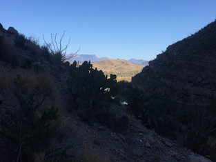
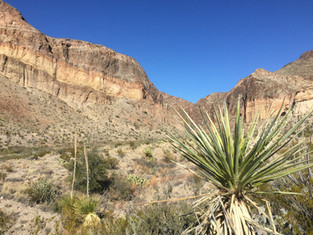
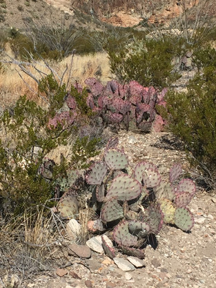
About halfway along the Ross Maxwell Scenic Drive is the turnoff to the parking area for the Lower Burro Mesa Pour-off Trail. It was not on my original hiking itinerary but I was struck by the beauty of the purple prickly pear cacti which grew in abundance in this area. The hike followed a dry creek bed and ended in a small enclosed canyon where the smoothed channel in the rock wall indicated where the water from the mesa above ran down.


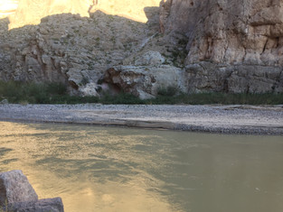
Boquillas Canyon Area
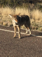
About 20 miles from Panther Junction at the eastern edge of the park lies the Boquillas Canyon Trailhead. On the way I pulled over twice, the first time to watch a couple of javelina cross the road. They were intent on their destination and quickly disappeared in the brush. However, the next denizen of the park I met was in no particular hurry to leave me. Using the road as his personal trail, a lone coyote ambled along obviously looking for a handout from the next passing traveler.
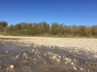
The hike into Boquillas Canyon was shorter and easier then Santa Elena following a sandy shoreline where I met a couple of locals from the far side of the river who had canoed across to sell their tiny pieces of art, copper wire and colorful beads twisted into the shapes of birds and scorpions. These little souvenirs can also be found in various nearby locations with plastic canisters where money is left on the honor system. Yes, I purchased several pieces. Not pictured below was my visit to the Boquillas border crossing where there was a small office, a single border agent and a middle-aged Mexican gentleman. Apparently, if you are so inclined and have a legal passport, the Mexican gentleman will escort you down to the river where he will ferry you across the river so that you may visit the tiny border village of Boquillas del Carmen. Even though it felt like a gratuitously touristy thing to do, I do hope that enough people take advantage of this opportunity to spend some much needed tourist bucks in the village.
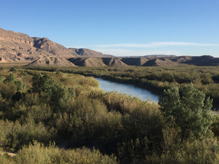
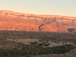
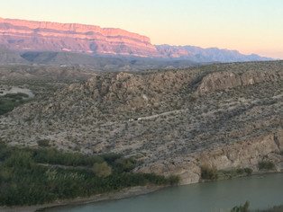
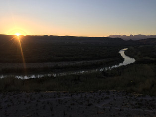
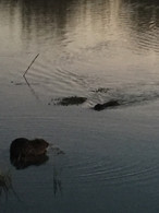
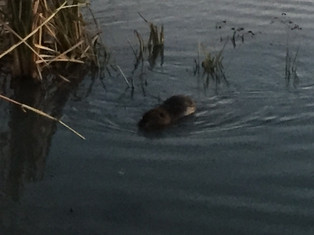
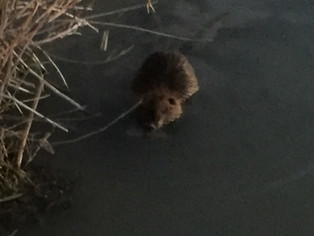
At day's end I made my way to the far end of the Rio Grande Village Campground and took the Rio Grande Village Nature Trail to the top of a bluff on a spit of land that sticks into the Mexican side where the river doubles back on itself. Sitting atop this bluff with a collection of campers I watched a lone horseman across the way herding black and white burros home in the gathering dusk and as the sun set, the opposing mountain range was illuminated in purple and rust. On my way back to the car, as I crossed the boardwalk I noticed something swimming in the marshy water. Best guess was a nutria, since it had a cylindrical tail and was larger than a musk rat.


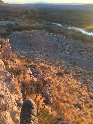


Hot Springs, Emory Peak, & Indian Head
Last day included a quick visit to the Boquillas hot springs along Hot Springs Historic Trail. The trail passed the remnants of a busier time when a general store and overnight accommodations existed, then hugged a cliff face where a few pictographs (not to be confused with petrogylphs) were still visible. The springs themselves were built for 8-10 people to soak comfortably with the warm waters spilling over directly into the river and was in full use. Looked like a great way to spend an evening after a day's hiking.
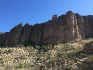
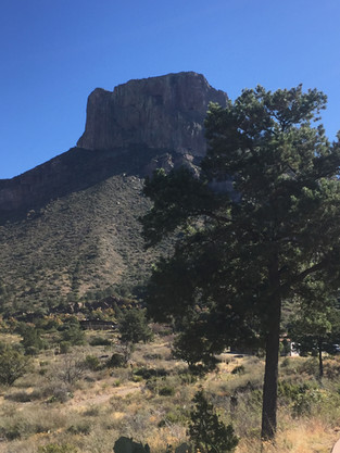
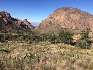
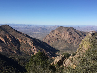
Emory Peak is the highest point in the range of the Chisos Mountains and was to be the featured hike of my visit to Big Bend. The trailhead is located in the very busy Chisos Mountains Lodge area and there were quite a few fellow adventurers making the ascent to the Pinnacles and beyond that day. The trail was clearly defined but it was a steep rocky climb with numerous switchbacks to reach the top of the Pinnacles where the final mile and a half along the ridge to the actual summit began. Plenty of time to contemplate the cautionary signs for black bear and mountain lion encounters which warned against crouching down yet still recommended somehow throwing sticks and stones.
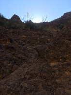
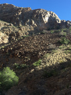
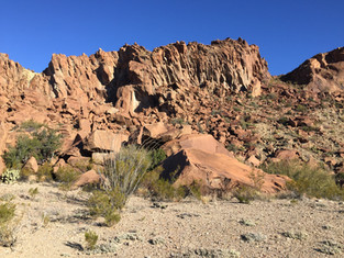
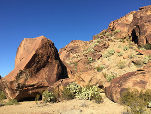
Final hike was accessed from the end of Indian Head Road, a mostly gravel drive that originated outside the park grounds next to the resort where I was staying. No clearly defined trail was evident and no actual petroglyphs were found, but there were some impressive red rock boulder fields.


Comments